Feeling uncertain about what to expect in your upcoming interview? We’ve got you covered! This blog highlights the most important Surveying and Layout interview questions and provides actionable advice to help you stand out as the ideal candidate. Let’s pave the way for your success.
Questions Asked in Surveying and Layout Interview
Q 1. Explain the difference between plane surveying and geodetic surveying.
The key difference between plane surveying and geodetic surveying lies in how they handle the Earth’s curvature. Plane surveying assumes the Earth is flat within the survey area, a reasonable approximation for smaller projects. Calculations are simplified using plane trigonometry. Geodetic surveying, on the other hand, explicitly accounts for the Earth’s curvature, using a geodetic datum and ellipsoidal geometry. This is crucial for larger-scale projects spanning significant distances, where ignoring the Earth’s curvature introduces unacceptable errors.
Think of it this way: If you’re surveying a small backyard, the assumption of flatness is perfectly fine. But if you’re surveying a large state, neglecting the Earth’s curvature would lead to significant inaccuracies in distances and positions. Geodetic surveying uses complex mathematical models to accurately represent the Earth’s shape and account for this.
Practical Application: Plane surveying is suitable for tasks like setting out building foundations or creating topographic maps of a small site. Geodetic surveying is essential for large infrastructure projects like pipelines, highways spanning large distances, and establishing national control networks.
Q 2. Describe the various types of surveying equipment and their applications.
Surveying relies on a variety of equipment, each tailored to specific tasks. Here are some key examples:
- Total Stations: These electronic instruments measure angles and distances simultaneously, automating many surveying tasks. They are used extensively in construction, land surveying, and engineering projects for accurate positioning and data collection.
- Global Navigation Satellite Systems (GNSS) Receivers (e.g., GPS): GNSS receivers use satellite signals to determine precise coordinates. They are invaluable for mapping, positioning, and navigation in various applications, from precision agriculture to autonomous vehicles.
- Levels (Optical and Digital): Used for determining elevations and establishing level benchmarks. Optical levels require a level rod, while digital levels provide automated readings and data logging. They’re crucial in construction for setting grades and in infrastructure projects for establishing precise elevations.
- Theodolites: These precision instruments measure horizontal and vertical angles, primarily used in triangulation and traversing surveys to determine positions and bearings.
- EDM (Electronic Distance Measurement) Instruments: These instruments measure distances using electromagnetic waves. They’re often integrated into total stations but can also be used independently to measure distances accurately.
- Survey Tapes and Chains: These traditional tools are still used for measuring shorter distances, particularly in areas where more sophisticated equipment is impractical.
The choice of equipment depends on the project’s scale, accuracy requirements, and budget. For instance, a small residential survey might only need a total station and a level, while a large infrastructure project would likely involve GNSS receivers and advanced data processing software.
Q 3. How do you perform a traverse survey?
A traverse survey involves establishing a network of connected points (stations) whose relative positions are determined by measuring angles and distances. It’s a common method for mapping and setting out projects. Here’s a step-by-step process:
- Reconnaissance: Plan the traverse route, considering the terrain and accessibility. Select suitable points for stations.
- Establish Control Points: Start with at least one known point (control point), such as a previously surveyed benchmark. This provides a reference for the entire traverse.
- Angle Measurement: Using a theodolite or total station, accurately measure the horizontal angles between consecutive legs of the traverse.
- Distance Measurement: Measure the distances between the established stations using an EDM instrument, total station or survey tape.
- Data Recording: Meticulously record all measurements, including angles, distances, and descriptions of each station. Consider factors like temperature and pressure, as these affect distance measurements.
- Data Processing and Adjustment: Using surveying software or manual calculations, compute the coordinates of each station. Due to unavoidable errors in measurement, the traverse will need to be adjusted to ensure geometric consistency. Least squares adjustment is a commonly used technique.
- Error Analysis: Evaluate the accuracy of the survey by analyzing the closing error – the difference between the computed coordinates and the known coordinates of the starting and ending points.
Example: Imagine mapping a field. You’d establish a series of points around the field’s perimeter, measuring the angles and distances between them. After calculation and adjustment, you’d have a precise representation of the field’s boundaries.
Q 4. What are the different methods of leveling?
Leveling is the process of determining the relative elevations of points. Several methods exist:
- Spirit Leveling (Differential Leveling): This is the most common method, using an optical or digital level to establish a level line of sight and measuring the difference in elevation between points using a level rod. It’s a precise method used for establishing benchmarks and setting grades.
- Trigonometric Leveling: This method uses an angle measuring instrument (like a theodolite) to measure vertical angles and distances to determine elevations. It’s useful in situations where direct leveling is difficult, such as across valleys or obstacles.
- Barometric Leveling: This method uses a barometer to measure atmospheric pressure, which correlates with elevation. It’s less precise than spirit leveling and is typically used for less demanding applications.
Example: In construction, spirit leveling is crucial for ensuring accurate grading and drainage, while trigonometric leveling could be used to determine the elevation of a mountain peak.
Q 5. Explain the concept of error propagation in surveying.
Error propagation refers to how errors in individual measurements accumulate and affect the overall accuracy of the final results. In surveying, small errors in angles or distances, inevitable in any measurement process, can compound significantly, leading to significant inaccuracies in calculated coordinates or elevations. This is particularly important in large-scale surveys where the accumulation of small errors becomes substantial.
Example: A small error in measuring the length of one side of a triangle will influence the calculated area. Similarly, a minor error in measuring an angle in a traverse will propagate through subsequent calculations, leading to greater errors in the final coordinates of points further along the traverse.
Understanding error propagation is vital for designing surveys, choosing appropriate equipment, and employing robust data processing techniques. It helps in estimating the overall accuracy of the survey and in planning the field work effectively to minimize the effect of these errors. Statistical methods are often used to analyze and quantify the propagation of errors.
Q 6. How do you handle systematic and random errors in surveying measurements?
Surveying measurements are susceptible to both systematic and random errors. Handling them requires different approaches:
- Systematic Errors: These are consistent and repeatable errors caused by instrument malfunction, faulty calibration, or environmental factors (e.g., temperature). We address these by:
- Careful Calibration: Ensuring all instruments are properly calibrated before use.
- Instrumental Corrections: Applying corrections based on known instrument errors.
- Environmental Corrections: Adjusting measurements to compensate for temperature, pressure, or other environmental influences.
- Random Errors: These are unpredictable variations in measurements due to human error, instrument limitations, or other uncontrollable factors. We manage these through:
- Multiple Measurements: Repeating measurements several times and averaging the results. This helps reduce the influence of random errors.
- Least Squares Adjustment: Employing statistical techniques like least squares to adjust survey data and minimize the overall error within the network.
- Statistical Analysis: Analyzing the distribution of errors to assess the precision of the survey.
Example: If a total station’s angle measurement is consistently off by a certain amount, it’s a systematic error. If readings fluctuate slightly despite careful measurements, these are random errors. Effective surveying involves identifying and mitigating both types of errors to achieve acceptable accuracy.
Q 7. What are the common coordinate systems used in surveying?
Several coordinate systems are used in surveying, each with its own purpose and application:
- State Plane Coordinate System (SPCS): A system that divides states into zones, using different map projections within each zone to minimize distortion. This is widely used for land surveying within the United States.
- Universal Transverse Mercator (UTM): A global coordinate system that divides the Earth into 60 longitudinal zones. Each zone uses a transverse Mercator projection, making it suitable for mapping and geographic information systems (GIS).
- Geographic Coordinate System (GCS): Uses latitude and longitude to define locations on the Earth’s surface. This is often used in global positioning and navigation applications.
- Local Coordinate Systems: These are custom coordinate systems established for specific projects, often based on a local datum. They simplify calculations for smaller areas but lack the broader geographic referencing of systems like UTM or GCS.
The selection of the appropriate coordinate system depends on the project’s geographic extent, accuracy requirements, and integration with other data sources. For instance, a large-scale infrastructure project might use UTM for consistent referencing across a large area, while a local survey for a small construction site might use a local coordinate system.
Q 8. Describe the process of setting out a building from survey data.
Setting out a building involves transferring the design from the architect’s drawings onto the ground. This begins with accurate survey data, typically a site survey providing coordinates and levels. The process involves several key steps:
- Establishing Control Points: We start by establishing a network of control points on the site using precise techniques like GPS or Total Station surveying. These points form the basis for all subsequent measurements.
- Setting Out the Building Lines: Using the coordinates from the survey data and the building plans, we calculate the positions of the building corners and other key points. We then use a Total Station or other surveying equipment to physically mark these points on the ground, often using pegs or stakes.
- Leveling: Accurate leveling is crucial. We establish benchmarks (known elevations) and use levels to determine the exact height of the building’s foundation. This ensures the foundation is level and at the correct height.
- Checking and Verification: Throughout the process, we conduct rigorous checks to ensure accuracy. This includes double-checking measurements and comparing the set-out points to the design plans. We use various techniques like offsetting and triangulation to cross-check our work.
- Transferring Levels: The levels established at the control points are transferred to the individual building corners and foundation points using precise leveling techniques.
For example, imagine setting out a rectangular building. We’d first establish our control points, then use the coordinates to calculate the positions of the four corners. We’d then use a Total Station to precisely mark these points, ensuring they are at the correct distances and angles from each other. Regular checks are made to ensure the lines are perfectly square and the dimensions conform to the plans.
Q 9. Explain the principles of construction layout.
Construction layout is about accurately transferring design information onto the construction site. It involves precise measurements, careful planning, and a deep understanding of geometry and surveying principles. The core principles include:
- Accuracy: All measurements must be precise to avoid costly errors later in the construction process. Small errors can compound and lead to significant discrepancies.
- Control Network: Establishing a robust control network, as described in the previous answer, is essential. This provides a stable reference frame for all measurements.
- Clear Communication: Effective communication between surveyors, engineers, and construction crews is vital to ensure everyone understands the layout plan and their roles.
- Proper Documentation: Meticulous record-keeping is essential, including all measurements, calculations, and any adjustments made during the process. This allows for troubleshooting and future reference.
- Understanding of Tolerances: Construction allows for certain tolerances, but staying within these limits is crucial for a successful project. Knowing these tolerances and working within them is critical.
Think of it like building with Lego: if the initial blocks aren’t placed perfectly, the entire structure will be off. Construction layout ensures the ‘foundation blocks’ are placed perfectly, providing a strong base for the entire project.
Q 10. How do you ensure accurate measurements in challenging terrain?
Challenging terrain presents unique obstacles in surveying. To ensure accuracy, we employ several strategies:
- Advanced Equipment: Utilizing robotic total stations and GPS/GNSS receivers with Real-Time Kinematic (RTK) capabilities allows for highly accurate measurements even in difficult conditions. RTK dramatically reduces the impact of atmospheric effects on accuracy.
- Multiple Setups: In areas with limited sight lines, we may use multiple instrument setups to ensure we can accurately measure all points. Triangulation and other geometric techniques are utilized to independently verify measurements.
- Careful Planning: Before commencing fieldwork, we carefully plan the survey route, considering potential obstacles and the best measurement techniques to employ. This includes considering the impact of terrain on signal reception for GPS.
- Traverse Surveys: For areas where direct line-of-sight is not possible, a traverse survey, where measurements are made along a series of connected lines, is a useful technique. This method builds upon known points and provides a reliable chain of measurement.
- Data Quality Control: Regular data checks are done to identify outliers and potential errors during the field work and subsequent data processing. This includes residual analysis to detect any systematic issues with the measurement techniques.
For instance, surveying on a steep hillside requires careful planning of instrument positions to avoid slope-related errors. We would likely use RTK GPS to account for the uneven terrain and employ multiple setups to ensure comprehensive coverage.
Q 11. What software packages are you familiar with for surveying and CAD?
I am proficient in several software packages commonly used in surveying and CAD:
- AutoCAD: A widely used CAD software for creating and editing drawings. I’m experienced in producing detailed site plans, sections, and construction drawings.
- Civil 3D: Autodesk’s civil engineering software suite, particularly useful for surface modeling, earthwork calculations, and generating design plans for infrastructure projects.
- MicroStation: Bentley Systems’ CAD software. I have experience working with its powerful modeling and design tools for various engineering projects.
- Trimble Business Center (TBC): A comprehensive post-processing software for GPS and Total Station data. I’m adept at processing raw survey data, creating accurate models, and generating reports.
- Leica GeoMoS: I’m also familiar with Leica GeoMoS, used for planning, controlling, and processing data collected using Leica surveying equipment.
My expertise extends to using these software packages in conjunction with each other to ensure a seamless workflow from data acquisition through to design and documentation. For example, I regularly use TBC to process GNSS data, then import that data into Civil 3D to create a detailed 3D model of the site.
Q 12. Describe your experience with GPS/GNSS surveying.
I have extensive experience with GPS/GNSS surveying, using both static and RTK methods. My experience includes:
- Data Acquisition: Operating various GNSS receivers and understanding the importance of optimal antenna placement and base station configuration.
- Post-Processing: Using specialized software to process raw GNSS data, correct for atmospheric effects, and achieve centimeter-level accuracy. This involves understanding the various corrections needed for the best possible results.
- RTK Surveying: I am proficient in using RTK techniques to achieve real-time, high-precision positioning, ideal for construction layout and other applications where immediate results are crucial.
- Network RTK: Experience using Network RTK systems, where corrections are broadcasted from a network of reference stations, eliminating the need for a separate base station. This is efficient for large projects across a wide geographic area.
- Various Applications: I’ve used GPS/GNSS technology for various tasks, including site surveys, topographic mapping, construction layout, and monitoring of deformation.
For example, I recently used RTK GPS to set out the foundations of a large commercial building, achieving millimeter accuracy in the placement of foundation points. The speed and precision of RTK made the process highly efficient and minimized potential errors.
Q 13. How do you deal with obstructions during surveying?
Obstructions during surveying are a common challenge. The approach depends on the type of obstruction and the required accuracy. Here are some strategies:
- Alternative Measurement Techniques: If a direct sightline is blocked, we might use indirect measurements like traversing, triangulation, or offsetting to determine the coordinates of the obstructed point.
- Using Shorter Wavelengths: In dense vegetation, using GNSS with higher frequency signals can improve signal penetration, though accuracy can be reduced.
- Removal of Obstructions (if feasible): In some cases, it may be possible to temporarily remove or relocate minor obstructions, such as small bushes or debris.
- Reflective Prisms: When using a total station, using strategically placed reflective prisms to bounce signals around obstructions can extend the range and overcome sightline problems.
- Detailed Field Notes: Careful field notes are crucial to document the chosen methods, any limitations, and assumptions made. This information is important for data processing and interpretation.
Imagine a tall building blocking the view between two points you need to measure. We would use techniques like triangulation, setting up instruments at strategic points around the building to create a network of interconnected measurements and calculate the required distances.
Q 14. Explain the importance of quality control in surveying.
Quality control in surveying is paramount, ensuring the accuracy and reliability of the data. It involves several aspects:
- Instrument Calibration: Regular calibration of all surveying equipment, including Total Stations, levels, and GNSS receivers, is essential to maintain accuracy. This involves comparing the instruments readings to known standards.
- Independent Checks: Employing independent checks and cross-verification of measurements is crucial. This involves multiple measurements of the same point using different methods to identify discrepancies.
- Data Validation: Careful review and analysis of the collected data is essential, identifying any outliers or inconsistencies that may indicate errors.
- Error Propagation: Understanding how errors can propagate through calculations and measurements is critical. We use statistical methods to quantify and minimize the impact of errors.
- Documented Procedures: Following established procedures and keeping detailed records of all measurements and calculations allows for easy review and identification of any potential problems.
Quality control is not just about catching mistakes; it’s about building trust and confidence in the data. Imagine a bridge collapsing due to inaccurate surveying data – quality control ensures such disasters are avoided by rigorously checking measurements at every stage.
Q 15. What safety procedures do you follow during surveying work?
Safety is paramount in surveying. My safety procedures begin with a thorough site assessment before any work commences. This involves identifying potential hazards like uneven terrain, overhead power lines, traffic, and weather conditions. We always use appropriate personal protective equipment (PPE), including hard hats, safety vests, high-visibility clothing, and safety glasses. When working near roads, we implement traffic control measures, such as cones and signage. For fieldwork involving steep slopes or precarious locations, we use harnesses and ropes. Regular communication within the survey team is crucial, ensuring everyone is aware of their surroundings and potential risks. Before using any equipment, we perform pre-operational checks to ensure proper functionality and safe operation. Finally, we maintain a strict adherence to all relevant safety regulations and company safety policies.
For example, during a recent project near a busy highway, we implemented a full traffic management plan, including flaggers and designated safety zones, to ensure the safety of both our crew and the public. This proactive approach prevented any accidents and ensured a smooth and safe survey operation.
Career Expert Tips:
- Ace those interviews! Prepare effectively by reviewing the Top 50 Most Common Interview Questions on ResumeGemini.
- Navigate your job search with confidence! Explore a wide range of Career Tips on ResumeGemini. Learn about common challenges and recommendations to overcome them.
- Craft the perfect resume! Master the Art of Resume Writing with ResumeGemini’s guide. Showcase your unique qualifications and achievements effectively.
- Don’t miss out on holiday savings! Build your dream resume with ResumeGemini’s ATS optimized templates.
Q 16. Describe your experience with different types of surveying instruments (e.g., theodolites, total stations).
I have extensive experience with various surveying instruments. I’m proficient in using theodolites for precise angle measurements, understanding their functionalities such as horizontal and vertical circle readings, and how to accurately level them. Total stations, which combine the functionality of a theodolite, an electronic distance meter (EDM), and a data recorder, are my primary tools for most projects. I’m familiar with their various functionalities, including robotic operation, data collection, and processing. I can effectively use total stations to perform tasks such as traversing, setting out points, and generating 3D models. I also possess experience with GPS receivers for precise positioning, understanding the intricacies of different satellite systems and their impact on data accuracy. I understand the importance of proper calibration and maintenance of all instruments to ensure data accuracy and longevity. For instance, I recently utilized a robotic total station to efficiently survey a large construction site, significantly reducing surveying time compared to traditional methods.
Q 17. How do you interpret survey data and create drawings?
Interpreting survey data involves analyzing the collected information to extract meaningful results. This typically starts with data processing, using software to adjust raw data for errors and create a coherent dataset. I use industry-standard software like AutoCAD Civil 3D to process data from total stations and GPS receivers. This often involves coordinate transformations, error analysis, and data filtering. After data processing, I use the information to create accurate drawings and plans. This involves using CAD software to plot points, create lines and curves, generate contours, and develop final drawings reflecting the surveyed area’s topography and features. For example, I’ve used processed data to create detailed site plans for construction projects, including accurate representation of boundaries, elevations, and existing utilities.
Creating drawings involves utilizing CAD software effectively to transform numerical data into visual representations. Understanding different map projections and scales is vital for creating appropriate drawings for different purposes. For example, a site plan might use a large scale to show detailed features, while a topographic map may utilize a smaller scale to represent a larger area.
Q 18. Explain the process of creating a topographic map.
Creating a topographic map involves a multi-step process. It begins with data acquisition, which can be through various methods such as Total Stations, GPS, or even drone-based surveying. The next step involves data processing, where raw data undergoes adjustments to account for errors. This cleaned data is then used to generate a digital terrain model (DTM) representing the Earth’s surface in 3D. From the DTM, contour lines representing elevations are automatically generated. The next phase focuses on map design and symbology, where features such as buildings, roads, water bodies, and vegetation are added using the proper symbols and scales. Finally, the map is compiled and reviewed for accuracy and clarity before it is finalized and produced. Think of it like building a 3D model of the terrain and then creating a 2D representation showing the ups and downs of the land.
Q 19. Describe your experience with boundary surveys.
I have significant experience in boundary surveys, which require a meticulous approach to defining property lines. This involves reviewing legal descriptions, deeds, and other relevant documents to understand the historical context of the boundaries. Field work includes locating existing markers, researching historical evidence, and establishing new markers where needed. Understanding legal principles related to boundary determination is crucial to ensure accuracy and avoid conflicts. Accurate measurements and calculations are fundamental to the process. For example, I recently completed a boundary survey for a property that had ambiguous descriptions in its deed. Through thorough research and field work, I was able to accurately define the boundaries and resolve the ambiguity, ultimately providing the client with clear and legally defensible property lines.
Q 20. How do you handle discrepancies in survey data?
Discrepancies in survey data are common and require careful investigation. The first step is to identify the source of the discrepancy. This could be due to instrumental errors, human error in data recording, or even discrepancies in existing records. I then carefully review the field notes and data processing steps to identify and rectify any mistakes. If the discrepancy is significant, I may conduct additional field measurements to verify the data. If discrepancies persist, I would consider consulting with senior surveyors or experts to determine the most likely solution. For instance, if there’s a significant difference between measured distances and distances indicated on a deed, I would meticulously investigate both the field measurements and the historical records to pinpoint the cause and resolve the discrepancy.
Q 21. What are your methods for calculating areas and volumes?
Area and volume calculations are fundamental to surveying. For area calculations, I employ various methods depending on the shape of the area. For simple shapes like rectangles or triangles, I use standard geometrical formulas. For irregular shapes, I use techniques such as coordinate geometry methods, planimetering (using a planimeter), or numerical integration methods. For volume calculations, I might use cross-section methods, where I calculate the area of numerous cross-sections and integrate them to find the total volume. Alternatively, for more complex volumes, I can use 3D modeling software to calculate the volume directly from the digital terrain model (DTM). For example, I recently calculated the volume of earthworks for a large-scale construction project using cross-section methods, ensuring accurate estimation for material procurement and cost management.
Q 22. Explain your understanding of legal aspects related to surveying.
Legal aspects in surveying are crucial; they govern how we collect, interpret, and use spatial data. This involves understanding property boundaries, easements, right-of-ways, and land titles. Errors can lead to costly legal disputes. For example, an inaccurate boundary survey could result in property line encroachment, leading to lawsuits and boundary adjustments.
- Property Law: Surveys define the legal boundaries of properties, determining ownership and preventing conflicts.
- Easements and Rights-of-Way: Surveys identify and depict legal access rights across properties, vital for infrastructure projects (pipelines, roads).
- Environmental Regulations: Surveys often inform environmental impact assessments, ensuring compliance with regulations related to wetlands, endangered species, and protected areas.
- Zoning Regulations: Surveys help determine if a construction project complies with local zoning laws regarding setbacks, building heights, and lot coverage.
- Professional Liability: Surveyors must maintain professional standards to avoid legal liability for errors or omissions in their work.
Understanding these aspects is critical for producing legally sound survey data and avoiding potential litigation.
Q 23. How do you manage a surveying crew effectively?
Managing a surveying crew effectively involves a blend of leadership, technical expertise, and interpersonal skills. It’s like conducting an orchestra—every member plays a crucial role, and they need to be in sync to produce accurate results.
- Clear Communication: Daily briefings are vital. Clearly outlining tasks, deadlines, and safety procedures ensures everyone is on the same page.
- Delegation & Teamwork: Assigning tasks based on crew members’ strengths promotes efficiency and team cohesion. A collaborative environment fosters problem-solving and boosts morale.
- Safety First: Regular safety checks and adherence to safety protocols are non-negotiable. This includes using appropriate personal protective equipment (PPE) and following site-specific safety plans.
- Training and Development: Providing opportunities for continuous learning and skill enhancement ensures the crew’s proficiency with new technologies and techniques.
- Motivation and Recognition: Acknowledging good work, celebrating achievements, and fostering a positive work environment helps retain skilled professionals and increases productivity.
I actively foster open communication and a safe environment, making sure each crew member understands their responsibilities and feels valued.
Q 24. Describe your experience with different types of survey projects.
My experience spans a diverse range of surveying projects. I’ve worked on everything from boundary surveys for residential properties to large-scale topographic surveys for infrastructure projects, and precise control surveys for construction.
- Boundary Surveys: Locating and marking property lines using deed descriptions and field measurements. This involves dealing with complex boundary issues, such as conflicting descriptions or adverse possession claims.
- Topographic Surveys: Creating detailed maps showing the earth’s surface features (elevation, contours, drainage). These are fundamental for planning and designing construction projects, roads, or utilities.
- Construction Surveys: Providing accurate measurements and stakeouts for construction activities. This is crucial to ensure buildings are placed correctly and that all components align as designed.
- Route Surveys: Mapping and designing routes for roads, pipelines, or railways. This includes horizontal and vertical alignment considerations.
- Hydrographic Surveys: Mapping the depths and features of water bodies. This involves specialized equipment and techniques.
Each project demands a unique approach and requires adapting my skills and knowledge to meet the specific requirements.
Q 25. How do you ensure the accuracy and precision of survey data?
Accuracy and precision are paramount in surveying. We achieve this through meticulous planning, precise measurements, and rigorous quality control.
- Calibration and Maintenance of Equipment: Regular calibration and maintenance of surveying instruments (total stations, GPS receivers, levels) ensure their accuracy. This includes checking for any drift or malfunction.
- Redundant Measurements: Repeating measurements and utilizing different methods adds confidence in the data and allows for error detection. For example, I frequently use independent observations to verify control points.
- Proper Data Collection Techniques: Following standardized procedures ensures consistent and reliable data acquisition. This includes proper instrument setup, aiming, and recording procedures.
- Quality Control Checks: Regularly reviewing and analyzing data during and after collection is crucial. This involves verifying the data’s consistency and reasonableness.
- Data Validation and Adjustment: Using appropriate adjustment techniques (least squares adjustment) to reconcile discrepancies and improve the overall accuracy of the data.
My approach to quality control minimizes errors and ensures reliable results.
Q 26. Explain your proficiency in data processing and analysis for surveying.
My proficiency in data processing and analysis involves using specialized software to convert raw field data into usable information. This extends beyond simply entering data – it’s about understanding the data’s implications and ensuring its reliability.
- Data Entry and Editing: Accurately entering field data into software packages like AutoCAD Civil 3D, ArcGIS, or other surveying software.
- Data Adjustment and Transformation: Employing appropriate coordinate systems and transformations to align data sets collected from different locations or using different methods.
- Error Detection and Correction: Identifying and resolving discrepancies, outliers, and blunders in the data.
- Data Analysis and Interpretation: Generating reports, maps, and other visual representations of spatial information to understand the data’s significance and make meaningful conclusions.
- Volume Calculations: Determining volumes of earthwork, stockpiles, or other materials using the processed survey data.
I’m adept at using various software packages and statistical techniques to ensure the integrity and reliability of survey data. For example, I regularly utilize least squares adjustment methods to improve data accuracy and detect systematic errors.
Q 27. How do you utilize GIS technologies in your surveying work?
GIS (Geographic Information Systems) technologies are indispensable tools for modern surveying. They allow us to visualize, analyze, and manage spatial data more effectively.
- Data Integration: GIS allows integration of survey data with other spatial datasets (satellite imagery, cadastral maps, etc.) to create a comprehensive understanding of the area.
- Data Visualization: Creating maps, charts, and 3D models to visualize survey data enhances communication and decision-making.
- Spatial Analysis: Conducting spatial analyses (e.g., proximity analysis, overlay analysis) to answer questions about spatial relationships and patterns.
- Data Management: GIS provides a structured framework for managing and organizing large amounts of spatial data.
- Project Planning and Design: Using GIS to plan and design projects, optimizing layouts, and minimizing conflicts.
I utilize ArcGIS and other GIS software to enhance my surveying projects. For example, I recently used GIS to analyze the optimal route for a new pipeline considering various environmental constraints and land ownership boundaries.
Q 28. Describe a challenging surveying project you’ve worked on and how you overcame the challenges.
One challenging project involved a topographic survey for a large-scale highway construction project in a mountainous region with dense vegetation. The terrain was extremely rugged, and accessibility was severely limited.
The primary challenges were:
- Difficult Terrain: Steep slopes, dense vegetation, and limited access roads made it difficult to reach many survey points.
- Adverse Weather Conditions: Frequent rain and fog caused significant delays and impacted the accuracy of GPS measurements.
- Time Constraints: The project had a tight deadline, placing pressure on the team to complete the survey efficiently.
To overcome these challenges, we implemented a multi-pronged approach:
- Strategic Planning: We meticulously planned the survey, optimizing the location of control points and survey lines to minimize the time spent in difficult terrain.
- Utilizing Different Technologies: We used a combination of robotic total stations, GPS receivers, and drones to gather data efficiently and overcome accessibility issues. Drones were especially helpful in capturing data from inaccessible areas.
- Adaptability and Teamwork: The team worked collaboratively and adapted our methods as needed, adjusting our plans based on the changing weather and terrain.
- Rigorous Quality Control: We implemented strict quality control procedures to ensure the accuracy of the data collected in challenging conditions.
Through meticulous planning, technology, and teamwork, we successfully completed the survey on time and within the required accuracy standards.
Key Topics to Learn for Surveying and Layout Interview
- Fundamental Surveying Principles: Understanding concepts like horizontal and vertical control, coordinate systems (e.g., UTM, State Plane), and different types of surveys (e.g., boundary, topographic, construction).
- Instrumentation and Technology: Familiarity with Total Stations, GPS/GNSS receivers, levels, and other surveying equipment. Understanding data collection methods and post-processing techniques.
- Data Processing and Analysis: Proficiency in using surveying software for data processing, adjustment, and analysis. Understanding error propagation and quality control measures.
- Layout Procedures: Knowledge of various layout methods, including using total stations and GPS for setting out points, lines, and grades. Understanding construction tolerances and their implications.
- Blueprint Reading and Interpretation: Ability to accurately interpret construction drawings, plans, and specifications to accurately perform layout tasks.
- Safety Procedures: Understanding and adhering to relevant safety regulations and procedures in the field.
- Legal Aspects of Surveying: Basic understanding of surveying legal principles and land ownership.
- Problem-Solving and Decision-Making: Demonstrating the ability to analyze situations, identify potential problems, and propose effective solutions in the field.
Next Steps
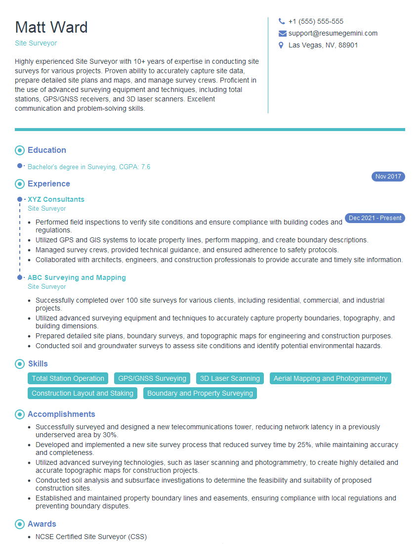
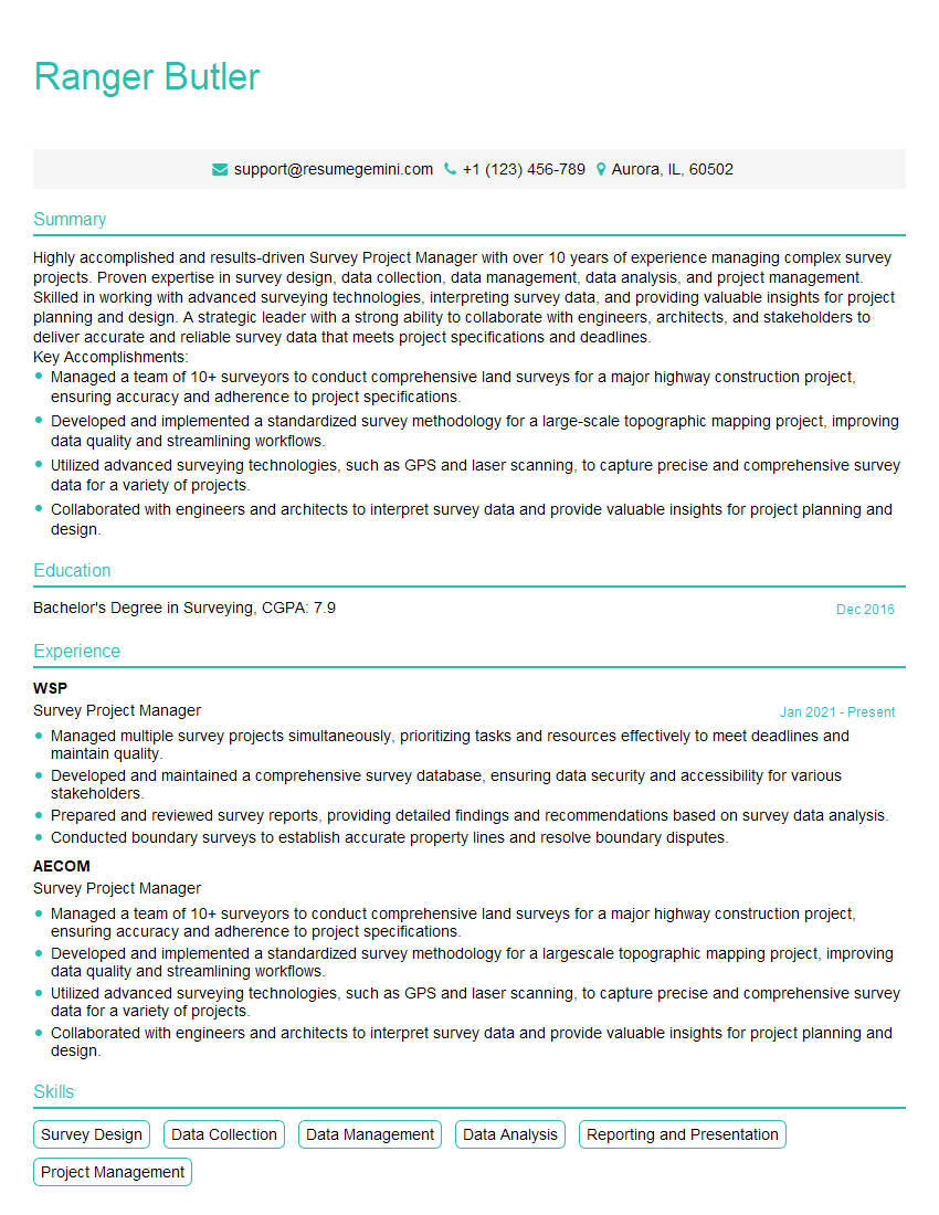
Mastering Surveying and Layout opens doors to a rewarding career with diverse opportunities in construction, engineering, and land development. To maximize your job prospects, focus on creating a strong, ATS-friendly resume that highlights your skills and experience effectively. ResumeGemini is a trusted resource that can help you build a professional resume tailored to the Surveying and Layout industry. Examples of resumes specifically crafted for this field are available to guide you.
Explore more articles
Users Rating of Our Blogs
Share Your Experience
We value your feedback! Please rate our content and share your thoughts (optional).
What Readers Say About Our Blog
This was kind of a unique content I found around the specialized skills. Very helpful questions and good detailed answers.
Very Helpful blog, thank you Interviewgemini team.


