The thought of an interview can be nerve-wracking, but the right preparation can make all the difference. Explore this comprehensive guide to Subterranean Surveying interview questions and gain the confidence you need to showcase your abilities and secure the role.
Questions Asked in Subterranean Surveying Interview
Q 1. Explain the difference between traditional surveying methods and modern subterranean surveying techniques.
Traditional subterranean surveying, often relying on rudimentary methods like tape measurements and compass bearings, is significantly less precise and efficient than modern techniques. Think of it like navigating with a paper map versus using GPS. Modern subterranean surveying leverages advanced technologies, offering greater accuracy, speed, and data richness.
Traditional: Primarily relied on manual measurements, often prone to human error and limited in scope. Data collection was slower and less comprehensive.
Modern: Employs sophisticated instruments like total stations, laser scanners, and inertial measurement units (IMUs) integrated with GPS. This enables 3D modelling, precise coordinate determination, and automated data processing, drastically improving accuracy and speed.
For instance, imagine surveying a mine shaft. Traditional methods might involve painstakingly measuring distances with a tape measure and angles with a compass, resulting in potential cumulative errors. Modern methods, however, allow for quick and accurate 3D mapping of the entire shaft, identifying potential hazards and optimizing resource extraction much more effectively.
Q 2. Describe your experience with various surveying instruments used in subterranean environments (e.g., total stations, laser scanners, GPS systems).
My experience encompasses a wide range of subterranean surveying instruments. I’m proficient in using total stations for precise distance and angle measurements in underground environments, even in challenging visibility conditions. These instruments, combined with appropriate reflectors, allow for accurate positioning of points within complex underground structures. Laser scanners are another crucial tool in my arsenal, providing high-density point cloud data for rapid 3D modeling of extensive underground areas. This is invaluable for creating detailed as-built models of mines, tunnels, or caverns. While GPS is less directly applicable *within* subterranean environments due to signal blockage, it plays a crucial role in georeferencing the survey data, connecting the underground measurements to the surface coordinate system. Finally, I’m experienced with inertial measurement units (IMUs) that, when integrated with other sensors, help track movement and orientation within GPS-denied environments.
Q 3. How do you handle challenges like limited visibility, unstable ground conditions, and confined spaces during subterranean surveying?
Subterranean surveying presents unique challenges, demanding creative solutions. Limited visibility is often addressed through the use of high-intensity lighting and specialized surveying equipment with robust illumination systems. For unstable ground conditions, meticulous safety protocols and the implementation of ground-penetrating radar (GPR) to assess subsurface conditions beforehand are crucial. This helps identify potential hazards and guide the survey process accordingly. Confined spaces require specialized equipment, such as smaller, more maneuverable total stations, and careful consideration of worker safety. This includes appropriate ventilation and emergency procedures.
For example, when surveying a collapsed mine tunnel, I would first deploy GPR to evaluate the stability of the remaining structure. Then, I would use a laser scanner mounted on a remotely operated vehicle (ROV) to safely map the inaccessible areas, minimizing risk to personnel. This combined approach ensures both data collection and the safety of the survey team.
Q 4. What are the different types of coordinate systems used in subterranean surveying, and when would you use each one?
Several coordinate systems are used in subterranean surveying, each suited to specific needs. The choice depends on the project’s scale, the type of data being collected, and the desired level of integration with other datasets. Common systems include:
Local Coordinate System: Used for smaller-scale projects where a local origin is established for relative positioning of points within a confined space, like a specific mine level. This is simpler to establish but does not directly relate to a global reference system.
State Plane Coordinate System (SPCS): A projected coordinate system tailored to specific states or regions. It provides a good balance between local relevance and a broader geographical framework, particularly useful for larger-scale projects spanning multiple sites.
Universal Transverse Mercator (UTM): A global coordinate system based on a cylindrical projection, allowing for consistent geospatial referencing across large areas. Crucial when integrating subterranean surveys with surface data.
Geographic Coordinate System (GCS) – Latitude/Longitude: Uses latitude and longitude to define location on the Earth’s surface and is especially useful for georeferencing and integrating subterranean data with other global datasets.
Choosing the appropriate coordinate system is essential for ensuring data compatibility and accuracy. A mine survey might utilize a local system for individual mine levels and then a UTM system to relate the different levels and their surface position.
Q 5. Explain your understanding of error propagation and its impact on subterranean survey accuracy.
Error propagation is the accumulation of errors from individual measurements throughout the survey process. In subterranean surveying, where measurements are often chained together, this can significantly impact accuracy. Even small errors in individual measurements, such as distance or angle, can compound, leading to substantial discrepancies in the final results. For instance, a small angular error in a long tunnel survey could translate into a significant positional error at the far end. This is particularly critical in complex underground environments where visibility and access are limited, making it challenging to perform frequent checks.
Understanding error propagation involves assessing the sources of error (instrumental, environmental, human), quantifying their impact, and applying appropriate error models and statistical analyses to minimize their effects. This includes utilizing redundancy in measurements and employing robust estimation techniques during data processing.
Q 6. How do you ensure the accuracy and precision of your subterranean survey data?
Ensuring accuracy and precision in subterranean surveying requires a multifaceted approach. This includes:
Calibration and Maintenance: Regular calibration of instruments is paramount. This ensures that the equipment is functioning optimally and that readings are accurate.
Redundant Measurements: Taking multiple measurements of the same feature helps identify and minimize errors. Comparing the results allows for the identification and rejection of outliers.
Quality Control Checks: Implementing rigorous quality control checks throughout the survey process is crucial to identify and address errors early on.
Appropriate Instrumentation: Selecting the right tools for the job is essential. Using high-precision instruments and selecting the right sensors for each task is critical.
Data Validation: Thorough data validation using various techniques ensures the consistency and reliability of the data collected.
Environmental Considerations: Accounting for environmental factors like temperature and humidity that might affect instrument performance.
For example, when surveying a network of tunnels, I would establish control points with multiple redundant measurements using a total station, and then use laser scanning to obtain a dense point cloud for detailed 3D modeling. This ensures the accuracy and completeness of the survey while managing the risks associated with working in potentially hazardous environments.
Q 7. Describe your experience with data processing and analysis software used in subterranean surveying (e.g., AutoCAD Civil 3D, Leica GeoMos, MineSight).
My experience with data processing and analysis software in subterranean surveying encompasses several leading packages. AutoCAD Civil 3D is frequently used for creating detailed 2D and 3D models of underground structures, including mine layouts, tunnel sections, and utility networks. Leica GeoMos is a powerful software for processing and analyzing data collected from Leica instruments, including total stations and laser scanners. It allows for precise point cloud registration, feature extraction, and 3D modeling. MineSight is a comprehensive mine planning and design software that incorporates survey data for accurate mine modeling, resource estimation, and production scheduling. I am adept at importing, cleaning, processing, and analyzing subterranean survey data within these platforms, generating reports, and creating visualizations for clients.
Q 8. How do you manage and integrate data from multiple sources in a subterranean surveying project?
Integrating data from multiple sources in subterranean surveying is crucial for creating a complete and accurate picture of the underground environment. This often involves data from various sources like Total Stations, laser scanners, drones with LiDAR, borehole logging tools, and even historical mine maps. The process starts with a robust data management plan.
- Data Standardization: Each data source has its own format. We convert all data into a common coordinate system (e.g., UTM) and datum to ensure compatibility. This might involve using software like AutoCAD Civil 3D or specialized surveying packages.
- Data Cleaning: Raw data is rarely perfect. We identify and correct or remove outliers and errors using statistical methods and quality control checks. This is vital for preventing inaccuracies in the final model.
- Data Integration: We use software capable of handling large datasets and different data types. This software allows us to register and merge data from multiple sources. For example, point clouds from laser scanning can be integrated with control points surveyed using a Total Station to build a high-resolution 3D model.
- Data Visualization: Finally, we visualize the integrated data in 2D and 3D formats, using software like ArcGIS or specialized geological modeling packages. This allows for thorough analysis and identification of potential issues or anomalies.
For example, in a mine surveying project, we might integrate data from a Total Station used for surface control points, a laser scanner used to create a high-resolution model of an underground chamber, and borehole data used to understand the geological strata. Proper integration of this diverse data allows us to create a comprehensive 3D model for mine planning and safety assessments.
Q 9. What safety precautions do you take when conducting subterranean surveys?
Safety is paramount in subterranean surveying. The underground environment poses numerous hazards, including confined spaces, hazardous gases, unstable ground, and the risk of equipment malfunctions. We implement rigorous safety protocols before, during, and after every survey.
- Risk Assessment: Before starting any survey, we conduct a thorough risk assessment specific to the site, identifying potential hazards and implementing control measures. This may involve reviewing existing geological reports and safety documentation.
- Personal Protective Equipment (PPE): Appropriate PPE is mandatory, including hard hats, safety boots, high-visibility clothing, respiratory protection (where needed), and hearing protection. We ensure everyone on the team is properly equipped and trained in its use.
- Gas Monitoring: In many subterranean environments, hazardous gases like methane or carbon monoxide are present. We utilize gas detectors to continuously monitor the atmosphere and evacuate the area if dangerous levels are detected.
- Emergency Procedures: Clearly defined emergency procedures, including evacuation plans and communication protocols, are established and regularly practiced by the survey team. This includes knowing the location of emergency exits and having access to communication devices.
- Proper Training: All personnel involved in subterranean surveys receive adequate training on safety procedures, confined space entry techniques, and emergency response. Regular refresher training is provided.
For instance, in a cavern survey, we might use specialized equipment and techniques for rope access, ensuring all team members are certified and experienced in these procedures. We would also maintain constant communication with surface personnel.
Q 10. Explain your understanding of different types of underground mapping (e.g., 2D, 3D, CAD models).
Underground mapping encompasses various methods to represent the subsurface environment, each with its strengths and limitations.
- 2D Mapping: Traditional 2D maps, often created using CAD software, provide a simplified representation of underground features, typically using cross-sections or plan views. They are useful for showing the layout of tunnels, shafts, or mine workings but lack the depth and detail of 3D models.
- 3D Mapping: This utilizes point cloud data from laser scanning or other 3D surveying techniques to create a detailed, three-dimensional representation of the underground space. This is invaluable for complex geometries and allows for more accurate volumetric calculations and spatial analysis.
- CAD Models: Computer-aided design (CAD) models are used to create detailed drawings and plans for underground infrastructure. They can integrate various data sources, including survey data, geological information, and design specifications. This allows for planning, design revisions, and simulations in a virtual environment.
For example, a 2D map might show the layout of a tunnel, while a 3D model would show the tunnel’s shape, size, and any geological features within or around it. CAD models then allow engineers to design support structures, ventilation systems, and other infrastructure within the confines of the tunnel.
Q 11. Describe your experience with different types of underground surveys (e.g., mine surveying, tunnel surveying, cavern surveying).
My experience encompasses a variety of subterranean surveying applications:
- Mine Surveying: This involves establishing and maintaining accurate control networks within mines, monitoring ground movements, and creating detailed maps of underground workings for mine planning, resource estimation, and safety management. I have worked on projects involving both surface and underground control networks, using Total Stations and GPS technology.
- Tunnel Surveying: This focuses on precise measurements and mapping of tunnels during construction and operation. It involves setting out tunnel alignments, monitoring tunnel deformation, and creating as-built drawings for documentation and future maintenance. I’ve used laser scanners and robotic total stations for precise and efficient data acquisition in this environment.
- Cavern Surveying: This often involves challenging access and surveying in complex, irregular spaces. It requires specialized techniques, such as rope access surveying and 3D laser scanning, to capture accurate data for geological studies, construction planning, or storage facility development. I’ve been involved in projects where we used drones with LiDAR to map inaccessible areas safely.
Each type requires specialized knowledge and equipment. For example, the techniques used for surveying a deep mine shaft differ significantly from those used in a large cavern.
Q 12. How do you perform volumetric calculations from subterranean survey data?
Volumetric calculations from subterranean survey data are crucial for various applications, including resource estimation in mines, volume calculations for underground storage, and assessing the stability of underground structures. The process typically involves using the 3D model created from the survey data.
- Point Cloud Processing: For 3D models generated from point cloud data, we use software to create a triangulated irregular network (TIN) or a mesh. This transforms the point cloud into a surface that can be used for volume calculations.
- Volume Calculation Methods: There are several methods for volume calculation, including the trapezoidal rule, Simpson’s rule, or more sophisticated algorithms available in specialized software. The choice depends on the complexity of the geometry and the desired accuracy.
- Software Applications: Software packages such as AutoCAD Civil 3D, MineSight, and Leapfrog Geo provide tools for automated volume calculations from 3D models. These packages allow for quick and accurate volume determination.
For example, in a mine, we might use the volume calculation to estimate the amount of ore remaining in a particular section of the mine, guiding further extraction activities. In an underground storage facility, accurate volume calculation is crucial for determining the storage capacity and managing inventory.
Q 13. How do you create and manage accurate subterranean survey drawings and maps?
Creating and managing accurate subterranean survey drawings and maps involves a systematic approach, ensuring consistency and clarity throughout the project lifecycle.
- Data Processing and Analysis: The raw data from various surveying instruments is processed and analyzed using specialized software. This involves data cleaning, coordinate transformation, and error correction.
- Drawing Creation: Using CAD software, we create detailed drawings and maps showing underground features, including tunnels, shafts, excavations, and geological formations. These drawings include accurate dimensions, labels, and annotations.
- Data Management: We use a structured data management system to store and organize all survey data and drawings. This includes naming conventions, version control, and backup procedures to prevent data loss. Cloud-based solutions are increasingly used for better collaboration and accessibility.
- Quality Control: Regular quality control checks are performed to ensure the accuracy and consistency of the drawings and maps. This may involve peer review and comparison with independent measurements.
- Revision Control: A revision control system tracks changes to the drawings and maps, ensuring that the latest version is always available and that any modifications are documented.
For example, a tunnel construction project will require ongoing updates to the as-built drawings throughout the construction phase, reflecting any deviations from the original design. These updated drawings are crucial for ensuring the successful completion of the project and for future maintenance.
Q 14. Explain your experience with the legal and regulatory aspects of subterranean surveying.
Subterranean surveying is subject to various legal and regulatory requirements, depending on the location and the type of project. Understanding and adhering to these regulations is critical for project success and avoiding legal liabilities.
- Health and Safety Regulations: Stringent health and safety regulations govern underground work, requiring compliance with safety standards, permits, and inspections. These regulations are specific to the type of underground environment and the activities being conducted.
- Environmental Regulations: Environmental regulations may apply, especially if the project involves excavation or the handling of potentially hazardous materials. Environmental impact assessments may be required, and strict procedures for waste disposal and pollution control must be followed.
- Land Ownership and Rights: Subterranean surveying projects must comply with land ownership laws and obtain the necessary permits and approvals. This is especially relevant when the survey work involves crossing property boundaries or accessing private land.
- Professional Standards: Surveyors are bound by professional codes of conduct and ethical standards, requiring accuracy, integrity, and responsible professional practice. This ensures the quality and reliability of the survey work.
- Data Privacy: Regulations regarding data privacy must be adhered to, ensuring the confidentiality and security of the collected data.
For instance, before conducting a survey in a historically significant area, we would consult with local authorities and potentially archaeological teams to ensure we comply with regulations and historical preservation laws. Similarly, mining operations will necessitate strict adherence to mine safety regulations and environmental protection guidelines.
Q 15. How do you handle discrepancies or inconsistencies in subterranean survey data?
Discrepancies in subterranean survey data are inevitable, given the challenging environment. Addressing them requires a systematic approach. I begin by visually inspecting the data for outliers or patterns suggesting errors. This might involve checking for spikes in readings or systematic biases. Then, I investigate the potential sources of the discrepancy. This could involve reviewing the survey equipment’s calibration records, checking for environmental influences (e.g., temperature fluctuations affecting distance measurements), or examining the survey methodology for potential weaknesses. For example, if using total stations, I’d check for prism misalignment or instrument instability. With laser scanning data, I’d look for occlusion or multipath effects.
After identifying the source, I employ appropriate correction techniques. This could involve applying corrections for instrument biases, adjusting for environmental factors using meteorological data, or re-processing the data using more sophisticated algorithms to filter out noise. In some cases, further field investigation might be necessary. If the discrepancy remains unexplained after rigorous analysis, I clearly document it in the final report, highlighting its potential impact on the project’s interpretation and recommendations.
For instance, during a recent mine survey, inconsistencies were noted in the elevation data of a particular section. Upon investigation, we discovered that the initial survey point was incorrectly established due to a localized ground movement. We implemented a revised survey strategy using more robust control points and a denser measurement network, resolving the inconsistencies.
Career Expert Tips:
- Ace those interviews! Prepare effectively by reviewing the Top 50 Most Common Interview Questions on ResumeGemini.
- Navigate your job search with confidence! Explore a wide range of Career Tips on ResumeGemini. Learn about common challenges and recommendations to overcome them.
- Craft the perfect resume! Master the Art of Resume Writing with ResumeGemini’s guide. Showcase your unique qualifications and achievements effectively.
- Don’t miss out on holiday savings! Build your dream resume with ResumeGemini’s ATS optimized templates.
Q 16. Describe your experience with GPS and RTK technologies in subterranean environments.
While GPS is limited in subterranean environments due to signal attenuation, Real-Time Kinematic (RTK) GPS offers some advantages in near-surface applications and for establishing control points. I have extensive experience using RTK GPS to establish surface control points for underground surveys, then using these points as a reference for total station or other subsurface techniques. The accuracy achievable with RTK GPS is significantly improved over traditional GPS, making it suitable for high-precision work.
However, the challenges in subterranean environments are substantial. The lack of clear sky view significantly affects the quality of RTK measurements. We often need to employ techniques like carrier phase measurements for better accuracy. Additionally, the need for reliable radio links and robust base station setups can add to the complexity. We might also use other technologies such as inertial measurement units (IMUs) in conjunction with RTK to navigate and increase accuracy in areas where satellite signals are weak or unavailable. I’m very familiar with managing these challenges and have successfully integrated RTK data into complex subterranean survey projects.
Q 17. Explain your understanding of deformation monitoring techniques in subterranean applications.
Deformation monitoring in subterranean environments is crucial for ensuring safety and structural integrity in mines, tunnels, and other underground structures. It’s often a crucial part of risk mitigation strategies. I’m experienced with several techniques including:
- Total station monitoring: Regular measurements to track changes in the position of strategically placed reflectors.
- Laser scanning: Creating detailed 3D models to detect millimetre-scale movements over time by comparing scans taken at different intervals.
- GPS and Inertial Navigation Systems (INS) based monitoring: Establishing stable reference points and monitoring displacements over long periods in larger areas.
- Extensometers and inclinometers: Direct measurements of ground strain and movement inside structures.
- Fiber optic sensors: High precision distributed sensing for deformation monitoring along the length of an optical fiber.
The choice of technique depends on factors like the scale of the project, the required accuracy, and the specific type of deformation being measured. Analysis of the data often requires sophisticated software to identify trends and predict future behaviour. For example, in a tunnel construction project, we used a combination of total station monitoring and inclinometers to continuously track wall movements, alerting the engineers to potential instability and allowing them to implement corrective measures proactively.
Q 18. How do you communicate technical information effectively to both technical and non-technical audiences?
Communicating technical information effectively is a crucial skill for any subterranean surveyor. I tailor my communication style to my audience. For technical audiences, I use precise terminology and detailed explanations, focusing on the intricacies of the data and methodology. My goal is to ensure they fully understand the technical aspects and implications of the survey.
When communicating with non-technical stakeholders, such as project managers or clients, I avoid technical jargon and focus on the practical implications of the survey results. I use clear, concise language, visuals like maps and diagrams, and analogies to make complex concepts easy to grasp. For instance, if explaining ground movement, I might use an analogy comparing it to the subtle shifting of sand dunes. Ultimately, I strive for transparent, accurate, and easily understandable communication to build trust and facilitate informed decision-making.
Q 19. Describe your experience with quality control and quality assurance in subterranean surveying.
Quality control (QC) and quality assurance (QA) are paramount in subterranean surveying because errors can have serious safety and cost implications. My QA/QC processes begin with meticulous planning of the survey, including defining clear objectives, specifying the required accuracy, selecting appropriate equipment, and establishing comprehensive field procedures. This includes calibrating equipment before, during and after surveys. During fieldwork, I implement rigorous QC checks at each stage of the survey, such as regularly verifying instrument readings and checking for potential biases. In my QC, I look for inconsistencies, outliers, and systematic errors. I document all findings. After field data collection, I implement post-processing QC measures including data validation, error analysis and outlier identification.
For example, I frequently use independent checks such as comparing total station measurements to GPS data, or comparing two different data sets taken using two different methods. All QC steps are meticulously documented, contributing to an auditable trail, demonstrating compliance to standards such as ISO 17125 or other relevant industry standards. This ensures high-quality results are delivered, contributing to the safety and efficiency of underground projects.
Q 20. How do you manage risk and identify potential hazards during a subterranean survey?
Risk management in subterranean surveying is paramount due to the inherent dangers of confined spaces, unstable ground conditions, and the potential presence of hazardous materials. My approach is proactive and multi-layered. It begins with thorough risk assessment identifying potential hazards such as ground instability, gas leaks, flooding, equipment malfunctions, or confined space hazards. I consider the specific environment and geological context of the project site.
Following risk assessment, I develop a comprehensive safety plan that incorporates mitigation strategies. This might involve implementing safety protocols, using appropriate personal protective equipment (PPE), employing specialized equipment or techniques to enhance safety. For example, in areas with potential methane gas accumulation, we’d use gas detectors and implement ventilation procedures before commencing work. Regular communication and coordination with the project team and other stakeholders are maintained throughout the project to address unforeseen issues promptly and effectively. Continual monitoring of the environment and review of safety procedures contribute to a proactive and efficient risk management system, reducing potential dangers in subterranean surveying projects.
Q 21. Explain your experience with different surveying software for data processing and analysis.
I have extensive experience with various surveying software packages for data processing and analysis. These include both industry-standard and specialized software tailored to subterranean applications. For example, I am proficient in using:
- MicroStation and AutoCAD Civil 3D: For drafting and 3D modeling of underground structures.
- Trimble Business Center (TBC) and Leica GeoOffice: For post-processing and adjustment of total station and GPS data.
- Riegl RiSCAN PRO and Cyclone: For processing and analyzing laser scanning data.
- Specialized mine planning software packages: Such as MineSight and Deswik, for integration of survey data into mine design and production plans.
My familiarity extends beyond basic data processing. I am skilled in using advanced geostatistical techniques to interpret subsurface data, creating models for resource estimation or ground stability analysis. Software selection depends on project-specific needs and data formats. My expertise allows for flexible adaptation and integration of various software and data sets for comprehensive analysis.
Q 22. What is your experience with different types of underground structures?
My experience encompasses a wide range of underground structures, from natural cavities like caves and mines to man-made structures such as tunnels, pipelines, and underground utilities. I’ve worked on projects involving detailed surveys of abandoned mines, assessing their stability and potential for collapse. This involved using various techniques like laser scanning and traditional surveying methods to create accurate 3D models. I’ve also been involved in the surveying of active mine workings, requiring careful coordination with mining operations and adherence to stringent safety protocols. Furthermore, I’ve conducted surveys for the planning and construction of new tunnels and underground infrastructure, ensuring accurate alignment and dimensioning.
- Example 1: A project involving the survey of a historical mine shaft required careful consideration of ground conditions and the potential for unstable areas. We used a combination of ground-penetrating radar (GPR) and traditional leveling to create a comprehensive map of the shaft.
- Example 2: In a recent project for a new subway tunnel, my work focused on precise alignment measurements using high-precision GPS and total stations, crucial for ensuring the successful integration of the new tunnel with existing infrastructure.
Q 23. Describe your approach to working independently and as part of a team.
I’m equally comfortable working independently and as part of a team. When working independently, I’m highly self-motivated and able to manage my time effectively to meet project deadlines. I’m proficient in planning and executing surveys with minimal supervision, ensuring accuracy and adherence to safety regulations. However, I thrive in a team environment. My experience working on large-scale projects has taught me the importance of collaboration, clear communication, and the sharing of knowledge and expertise. I actively contribute to team discussions, offering solutions and perspectives, and I’m always willing to assist colleagues when needed. I believe that successful subterranean surveys rely heavily on effective teamwork, particularly in challenging environments.
For example, during a recent survey in a confined space, my ability to collaborate effectively with my team, especially the safety officer, allowed us to overcome the challenges presented by the restricted space and ensure the safety of all personnel. This required clear communication about our planned survey method and a proactive approach to risk assessment.
Q 24. How familiar are you with different types of underground mapping software?
I’m highly proficient in using various underground mapping software packages. My expertise includes using CAD software like AutoCAD and specialized subterranean mapping software like Leapfrog Geo and MineSight. These platforms are crucial for processing and visualizing data acquired from different surveying instruments. I’m also familiar with data management systems and various geospatial databases used to store and retrieve underground survey data. This enables me to effectively manage, analyze, and interpret the collected data to create accurate and comprehensive underground models.
- AutoCAD: Used for creating detailed 2D and 3D drawings of underground structures.
- Leapfrog Geo: Excellent for 3D geological modeling and visualization from point cloud data.
- MineSight: Specialized software for mine planning and design, incorporating survey data for accurate mine modeling.
My experience extends to using these software packages to generate reports that include comprehensive maps, cross-sections, and 3D models of underground structures.
Q 25. Describe your experience with data visualization and reporting.
Data visualization and reporting are integral parts of my work. I’m adept at creating clear, concise, and informative reports that effectively communicate complex subterranean survey data to both technical and non-technical audiences. My reports typically include detailed maps, cross-sections, 3D models, and tables summarizing key findings. I utilize various visualization techniques, including contour mapping, 3D surface modeling, and geostatistical analysis, to highlight key features and patterns in the data. Software like ArcGIS and specialized geostatistical packages are frequently employed for creating these visualizations.
For instance, in a recent environmental impact assessment project, I used ArcGIS to create interactive maps showing the extent of subsurface contamination, allowing stakeholders to easily visualize the impact and understand the findings.
Q 26. How do you deal with challenges encountered while working underground?
Working underground presents unique challenges. Confined spaces, poor lighting, and the potential for hazardous conditions require careful planning and adherence to safety protocols. When encountering challenges, my approach is systematic. First, I assess the situation, identifying the specific problem and potential risks. Then, I develop a solution, considering available resources and safety regulations. This might involve adjusting the survey methodology, using alternative equipment, or seeking assistance from colleagues or specialists. Communication is crucial; I ensure that all team members are informed and involved in the problem-solving process.
For example, I once encountered a flooded section of a tunnel during a survey. Rather than proceeding, I immediately halted operations, notified the team, and assessed the risk. We implemented a safety plan, including using appropriate protective equipment and adjusting the survey route to avoid the flooded area, ensuring the safety of all team members.
Q 27. Explain your experience with environmental considerations in subterranean surveys.
Environmental considerations are paramount in subterranean surveys. I’m experienced in integrating environmental regulations and best practices into all aspects of my work. This includes understanding and complying with regulations related to groundwater protection, soil contamination, and the protection of endangered species. Surveys often involve assessing the potential environmental impacts of proposed underground projects, and I’m proficient in using appropriate techniques to minimize any negative effects. For instance, I understand the importance of proper waste disposal and minimizing ground disturbance during the survey process.
In a recent project involving the construction of an underground pipeline, my work included an assessment of the potential impact on groundwater resources. This involved careful planning of the drilling and excavation activities to minimize the risk of contamination and the installation of monitoring wells to track groundwater levels and quality.
Q 28. Describe your proficiency in using various surveying equipment.
I’m proficient in using a wide range of surveying equipment, both traditional and modern. This includes total stations, GPS receivers (both static and RTK), laser scanners, and ground-penetrating radar (GPR). I’m also skilled in using leveling instruments and other traditional surveying tools. My experience also encompasses data processing using specialized software packages for post-processing and quality control of the acquired data.
- Total Stations: Used for precise distance and angle measurements in underground environments.
- GPS Receivers (RTK & Static): Provide high-accuracy positioning data, crucial for large-scale mapping projects.
- Laser Scanners: Generate detailed 3D point clouds for creating accurate models of complex underground spaces.
- Ground-Penetrating Radar (GPR): Used to detect subsurface features and utilities without excavation.
Understanding the limitations and capabilities of each instrument is vital for selecting the appropriate technology for each project and ensuring data quality.
Key Topics to Learn for Subterranean Surveying Interview
- Instrumentation and Data Acquisition: Understanding various surveying instruments used in underground environments (e.g., total stations, laser scanners, GPS, inertial navigation systems). Focus on their limitations and accuracy in challenging subterranean conditions.
- Data Processing and Analysis: Mastering software and techniques for processing subterranean survey data, including coordinate transformation, error analysis, and 3D modeling. Consider practical applications like tunnel alignment verification or mine mapping.
- Underground Spatial Referencing: Deep understanding of coordinate systems and datums used in subterranean surveying, and how they differ from surface-based systems. Explore challenges related to datum transformations and accuracy implications.
- Safety Procedures and Regulations: Familiarity with safety protocols and legal requirements specific to underground surveying. This includes confined space entry, hazard identification, and risk mitigation strategies.
- Geological Considerations: Knowledge of basic geology and its impact on survey techniques. Understanding how geological formations affect instrument performance and data accuracy is crucial.
- Problem-solving and Decision-Making: Prepare to discuss scenarios requiring quick thinking and problem-solving in challenging underground settings. Examples might include dealing with instrument malfunctions or unexpected geological features.
- Common Subterranean Surveying Applications: Be prepared to discuss applications such as mining surveying, tunnel construction monitoring, utility mapping, and cave exploration, highlighting your experience or understanding of these areas.
Next Steps
Mastering subterranean surveying opens doors to a specialized and rewarding career with strong growth potential in diverse industries like mining, construction, and infrastructure development. A well-crafted resume is your key to unlocking these opportunities. To maximize your chances, focus on creating an ATS-friendly resume that highlights your skills and experience effectively. ResumeGemini is a trusted resource to help you build a professional and impactful resume. Examples of resumes tailored to Subterranean Surveying are available to guide you through this process.
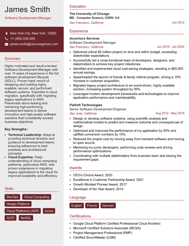
Check Out Resume Samples at ResumeGemini

Check Out Resume Samples at ResumeGemini

Check Out Resume Samples at ResumeGemini

Check Out Resume Samples at ResumeGemini

Check Out Resume Samples at ResumeGemini
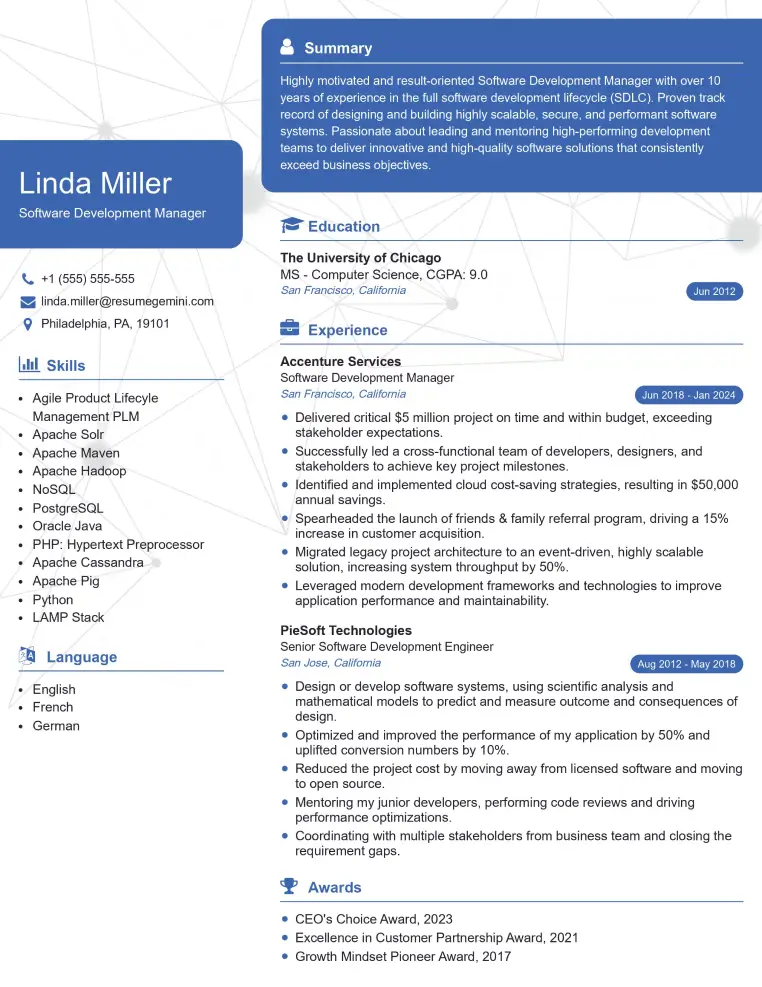
Check Out Resume Samples at ResumeGemini

Check Out Resume Samples at ResumeGemini
Explore more articles
Users Rating of Our Blogs
Share Your Experience
We value your feedback! Please rate our content and share your thoughts (optional).
What Readers Say About Our Blog
To the interviewgemini.com Webmaster.
Very helpful and content specific questions to help prepare me for my interview!
Thank you
To the interviewgemini.com Webmaster.
This was kind of a unique content I found around the specialized skills. Very helpful questions and good detailed answers.
Very Helpful blog, thank you Interviewgemini team.